Professional Land Surveyors
Platting and MBA
Platting is the process of creating a detailed map, called a plat, that shows how a piece of land is divided into smaller lots, roads, and other features. It is a crucial step in land development that legally defines property boundaries for subdivisions, commercial projects, and residential developments. Platting involves a survey of the land and ensures compliance with local regulations, and it is required before building permits can be issued or property can be sold.
A minor boundary adjustment is a small alteration to the property line between two or more adjacent parcels of land, used to fix errors, account for existing features, or consolidate lots. These adjustments are for insignificant changes that don't create new lots or increase density, and they often require a formal process including a survey and legal documentation, but are distinct from more significant subdivisions. Synonyms include minor lot line adjustment, boundary relocation, or administrative boundary adjustment.
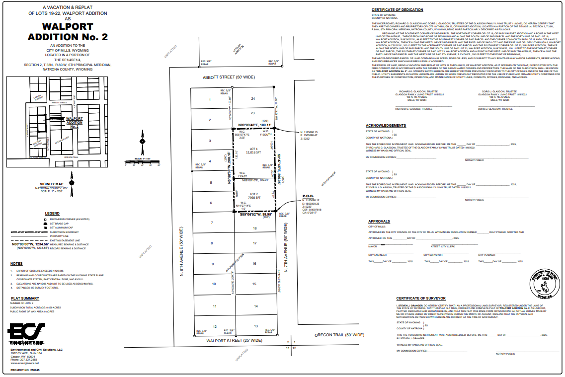
Boundary Retracement/ Lot and Acreage Adjustments
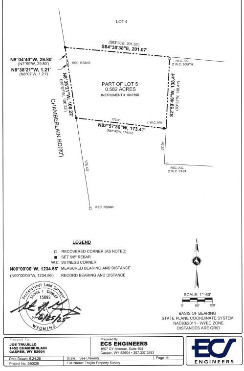
A boundary retracement is a type of land survey used to re-establish the original boundaries of a property by locating or marking the original corners and lines. It involves researching legal and historical documents, analyzing physical evidence on the land, and "retracing the footsteps" of the original surveyor to determine the property's true boundaries as they were legally established. This process is essential for resolving boundary disputes, real estate transactions, and property improvements
Acreage adjustment is the process of altering a property's value based on its size, most often used in real estate appraisals to account for differences between a subject property and comparable properties. It can also refer to an acreage adjustment clause in a contract that modifies the purchase price if the final measured acreage differs from what was stated. The adjustment is typically made by using a market-supported value per acre, and if a comparable property has a smaller lot, a positive adjustment is made, while a larger lot results in a negative adjustment.
All adjustments are recorded in the PLSS (Professional Land Surveyor System).
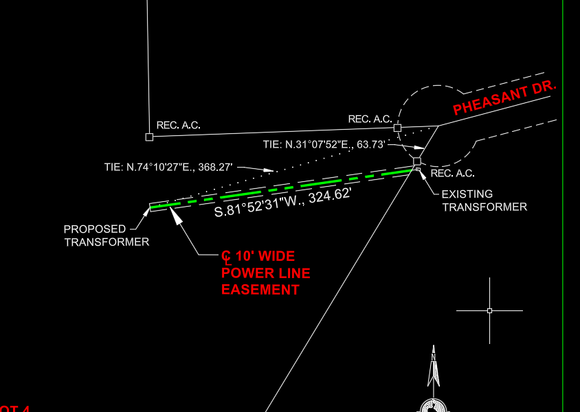
Easements and Right of Ways
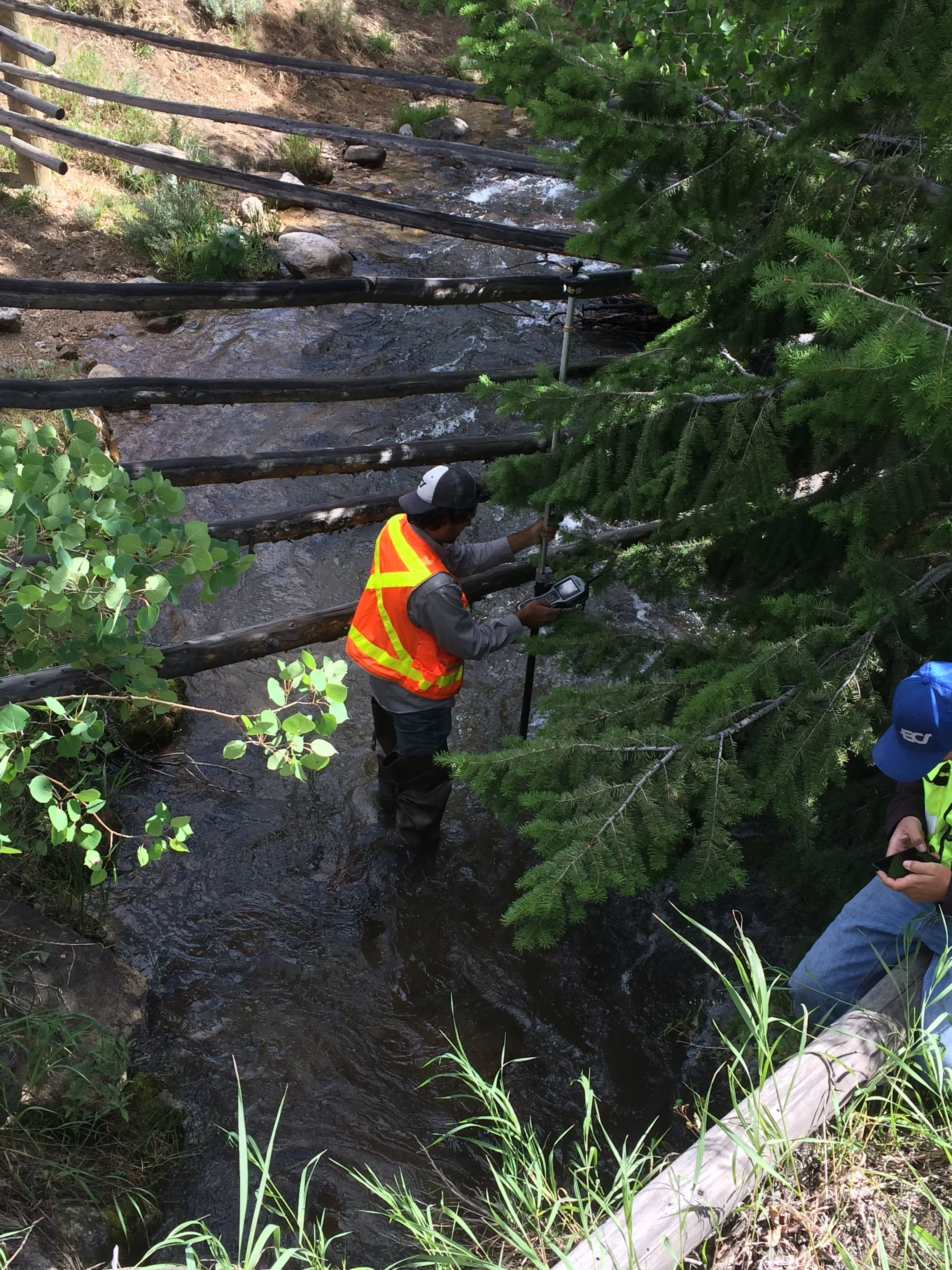
Surveying easements and rights-of-way establishes the legal right for someone other than the property owner to use a portion of that land for a specific purpose, such as access for roads, utilities, or pathways. An easement is the general legal right to use another's land for a specific purpose, while a right-of-way is a specific type of easement that grants the right to travel or pass over land. Surveying these areas is crucial for legal and development purposes, ensuring rights are protected and usage is compliant.
Residential and Commercial
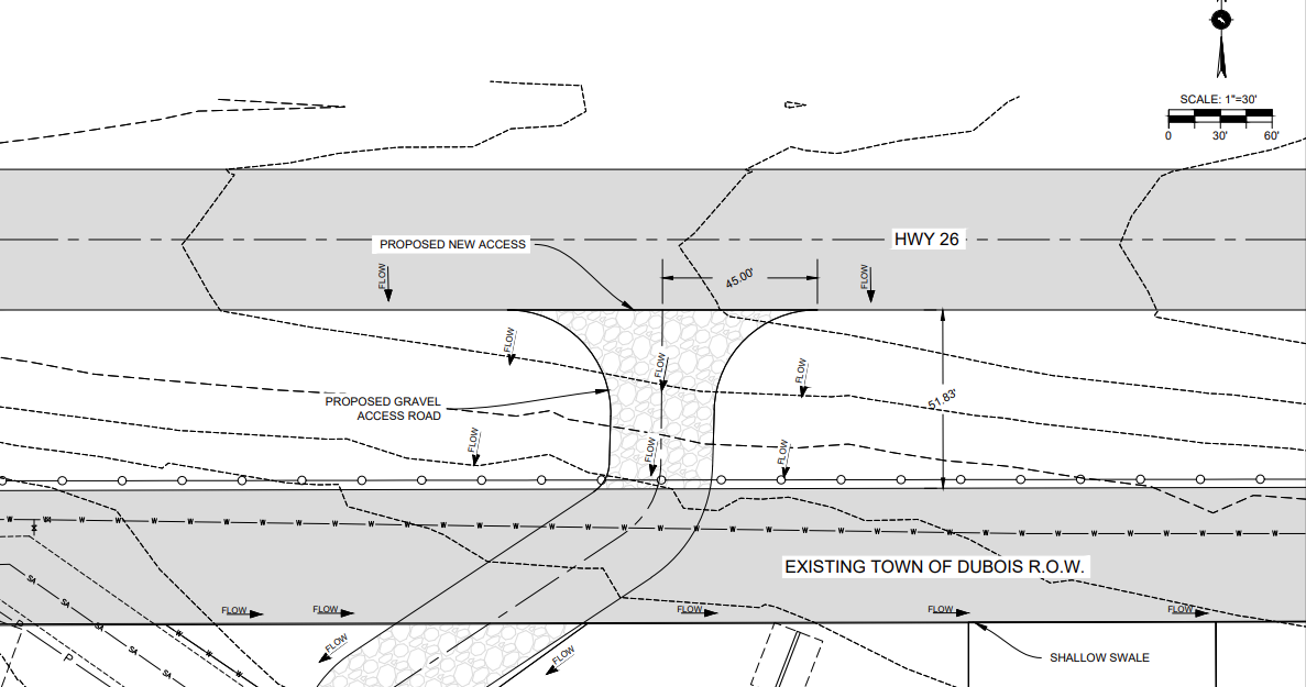
Construction staking, or construction layout, is the process of marking the locations of proposed buildings, roads, and other improvements on a construction site using physical markers like stakes. It involves using design plans and survey data to translate blueprints into tangible points on the ground, ensuring accurate horizontal and vertical placement of all features. This is a critical first step that provides the physical reference needed for construction to proceed accurately and efficiently.
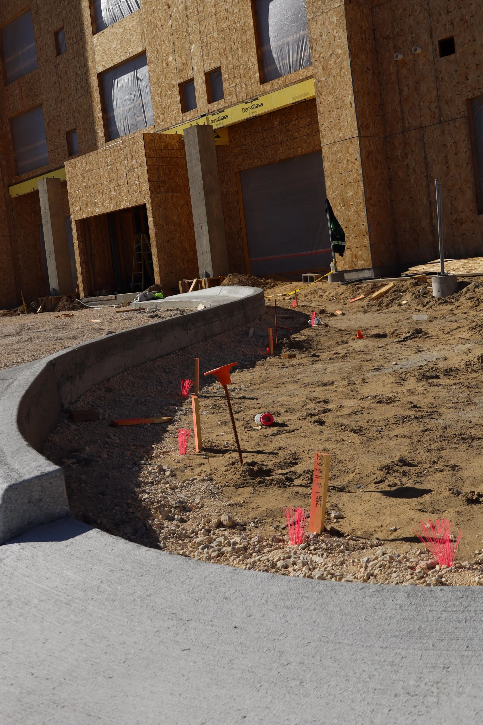
Topo Design and As Built Surveys
A topographic (topo) design is the plan for how a piece of land's surface will be changed and improved, created using data from an initial topographic survey. An as-built survey is a survey conducted after construction to document the precise, final built conditions and verify that the work aligns with the approved plans.
An as-built survey is a field survey that documents the actual, final conditions of a site after construction or at various stages of the project.
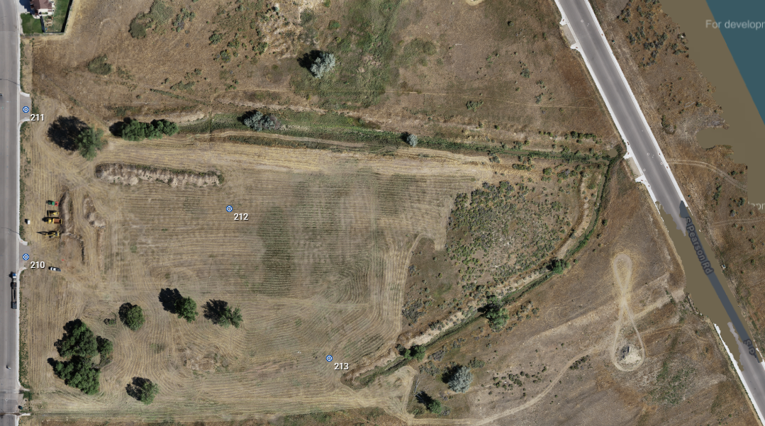
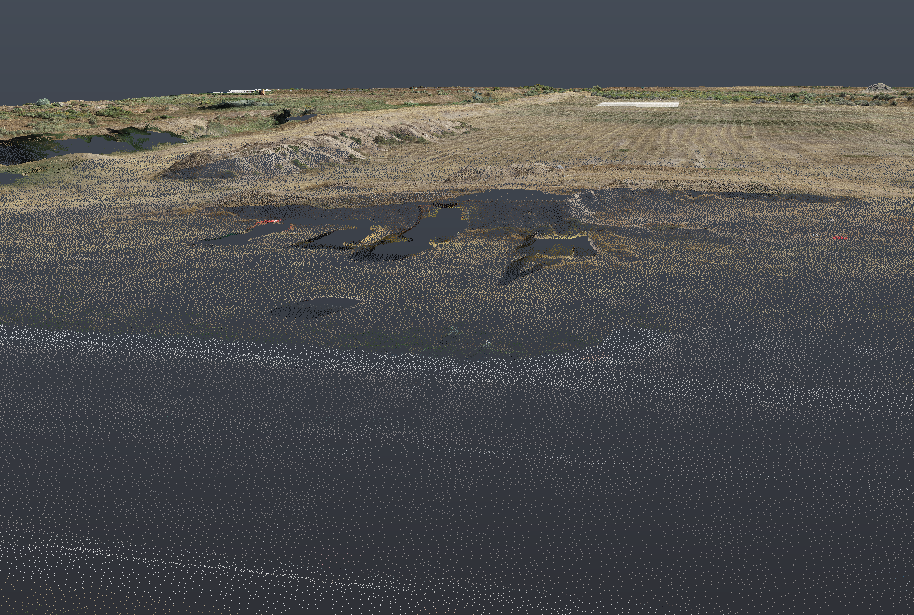
Aerial Surveying
Our aerial surveying uses Unmanned Aerial Vehicles (UAVs) with cameras and sensors to collect data for creating 2D maps and 3D models of an area. This method is a faster, safer, and more cost-effective alternative to traditional surveying, used in industries like construction, agriculture, and land development to perform tasks such as creating topographic maps, calculating volumes, and inspecting infrastructure.


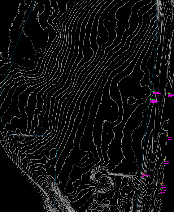
Conventional Surveying
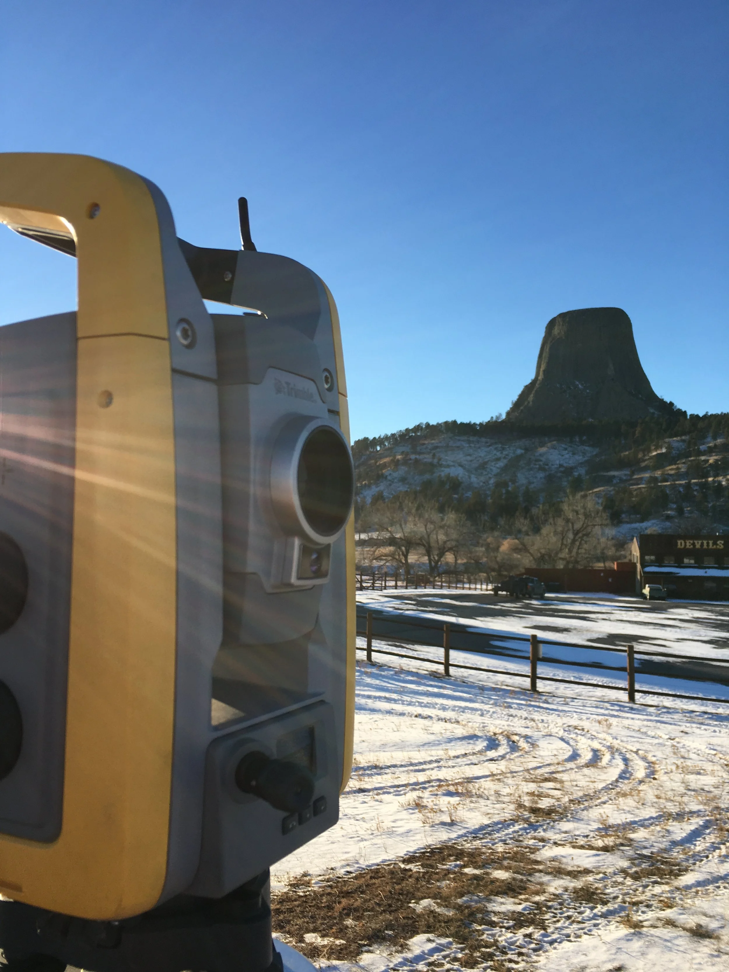
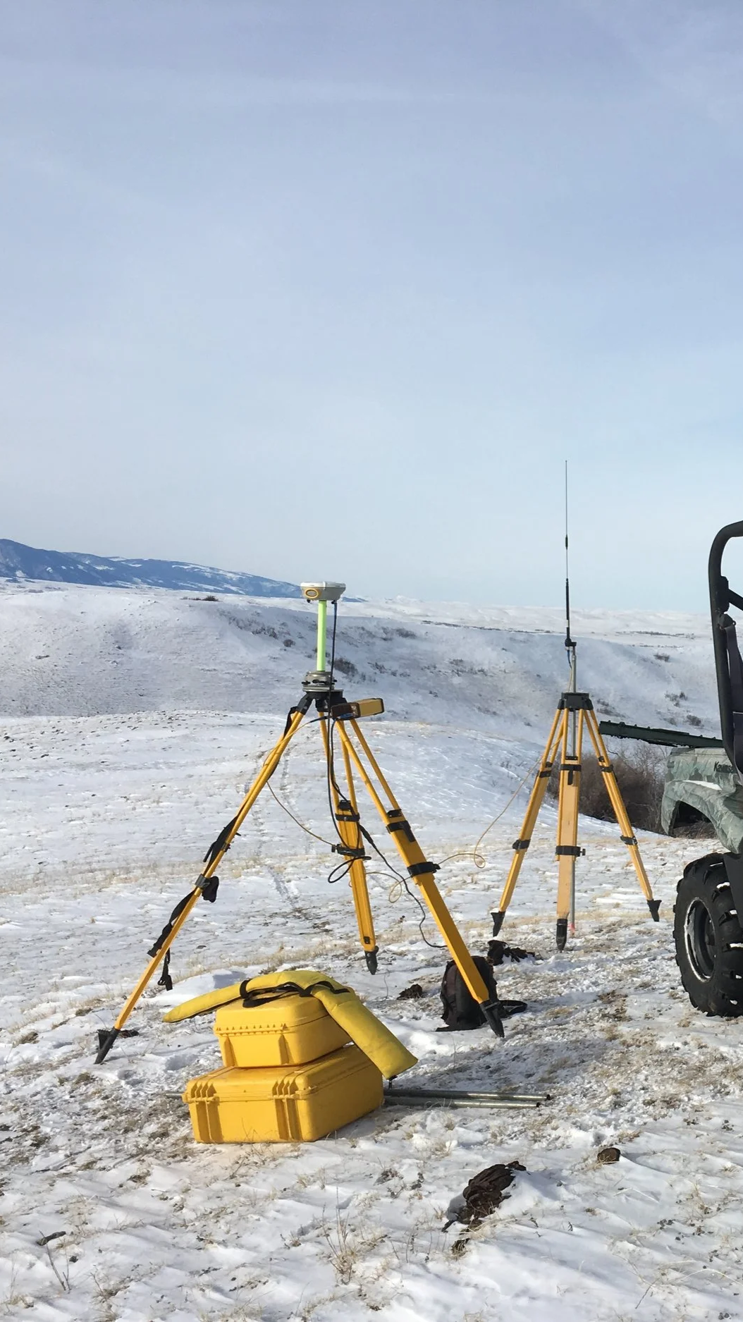
Conventional surveying, also known as traditional surveying, is a ground-based method that uses manual and optical tools like total stations, theodolites, and levels to measure distances, angles, and elevations. This hands-on process is used to create accurate maps, plans, and models for projects such as defining property boundaries, construction, and infrastructure development.
Route Surveys
A route survey is a process of collecting detailed data on a proposed path for a project, such as a highway, railroad, or utility line, to ensure it is feasible and safe. It involves fieldwork to document the existing topography, man-made obstacles, and alignment to plan for construction or to verify a route is suitable for moving an oversized load.
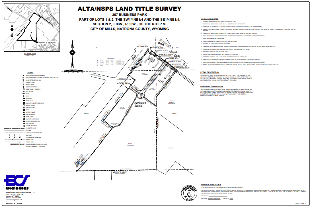
ALTA Surveys
An ALTA survey is a comprehensive, detailed land survey that meets the standards set by the American Land Title Association (ALTA) and the National Society of Professional Surveyors (NSPS). It is considered the "gold standard" for commercial real estate and provides critical information on property boundaries, easements, encroachments, and improvements to help title companies, lenders, and buyers assess risk and insure property titles.
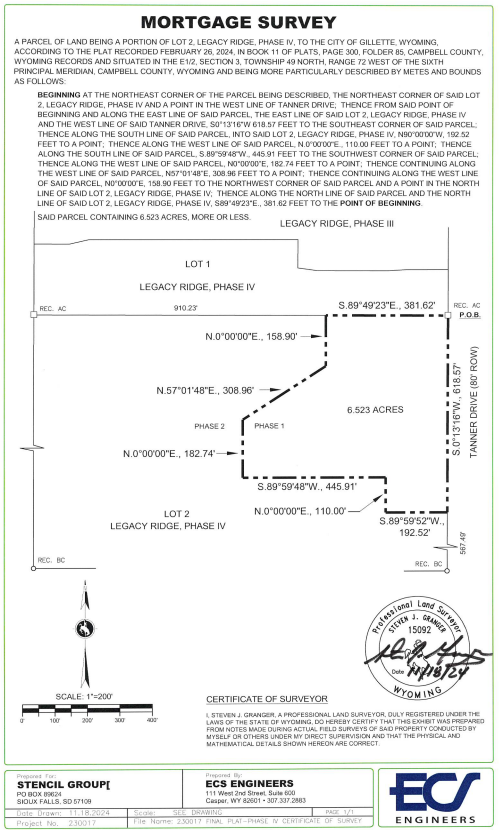
Mortgage Surveys
A mortgage survey is a type of land survey that confirms a property's boundaries, verifies its legal description, and identifies any potential issues like encroachments or easements. It is often required by lenders to ensure the property is worth the loan amount and that the legal description matches the physical property, which provides peace of mind for the buyer.